
Train-Corse.com is evolving with the launch of a brand-new interactive map dedicated to the Chemins de Fer de la Corse.
This new feature offers a more modern, visual and intuitive way to discover Corsica’s railway network, on both computers and smartphones.
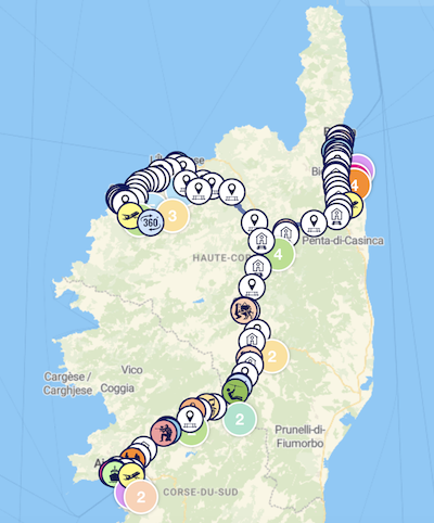
Explore Corsica along its railway lines
The interactive map shows the CFC network’s lines between Bastia, Ajaccio, Ponte-Leccia, Calvi and l’Île-Rousse, together with the stations and stops served.
It also helps you discover many places of interest within reach of the railway:
- panoramas and viewpoints;
- beaches;
- heritage sites and villages;
- museums;
- nature;
- leisure activities;
- ports and airports;
- outdoor activities such as canyoning, treetop adventure courses, rafting, via ferrata and paragliding.
Each point on the map has an information window with a photograph, a category and a link to a detailed page where available.
Navigation designed for every screen
The map includes interactive filters that display only your chosen categories, making it easier to plan discoveries around Corsica’s railway.
The interface is designed for smooth navigation, with:
- dynamic grouping of points on the map;
- custom zoom;
- a display optimised for mobile;
- an interactive sidebar;
- custom icons for each category.
A map that will keep evolving
This interactive map will gradually be enriched with new places, categories and improvements, becoming a guide to discovering Corsica by train.
Discover the new interactive map now at:
www.train-corse.com/carte-interactive