
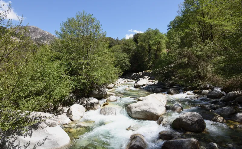
Upper Gravona valley
The Gravona valley from station to station
Choose a stage between Carbuccia, Ucciani, Tavera and Bocognano, follow the old paths of the Celavu and rejoin the railway in the valley.

The valley seen from its paths
The railway follows the Gravona upstream; the paths invite you into the villages. Between Carbuccia and Bocognano, this change of pace is what makes walking so rewarding. Leave a stop, reach the houses, then follow a passage between two walls towards the old cultivated land. A chapel, a fountain or a small stone structure provides a landmark. The wooded slopes and granite mountains remind you that the upper valley is already mountain country.
‘From station to station’ does not mean a single path running beside the rails. Instead, you can put together an outing using three stages between villages and their rail connections. One stage is enough for a relaxed day with breaks; several can be combined if walking time and trains allow. This gives the villages a proper place in the day rather than treating them as points to pass through. It also means distinguishing the station from the village: the walks linking them are part of the day, even when they are not included in the distances shown.
The route
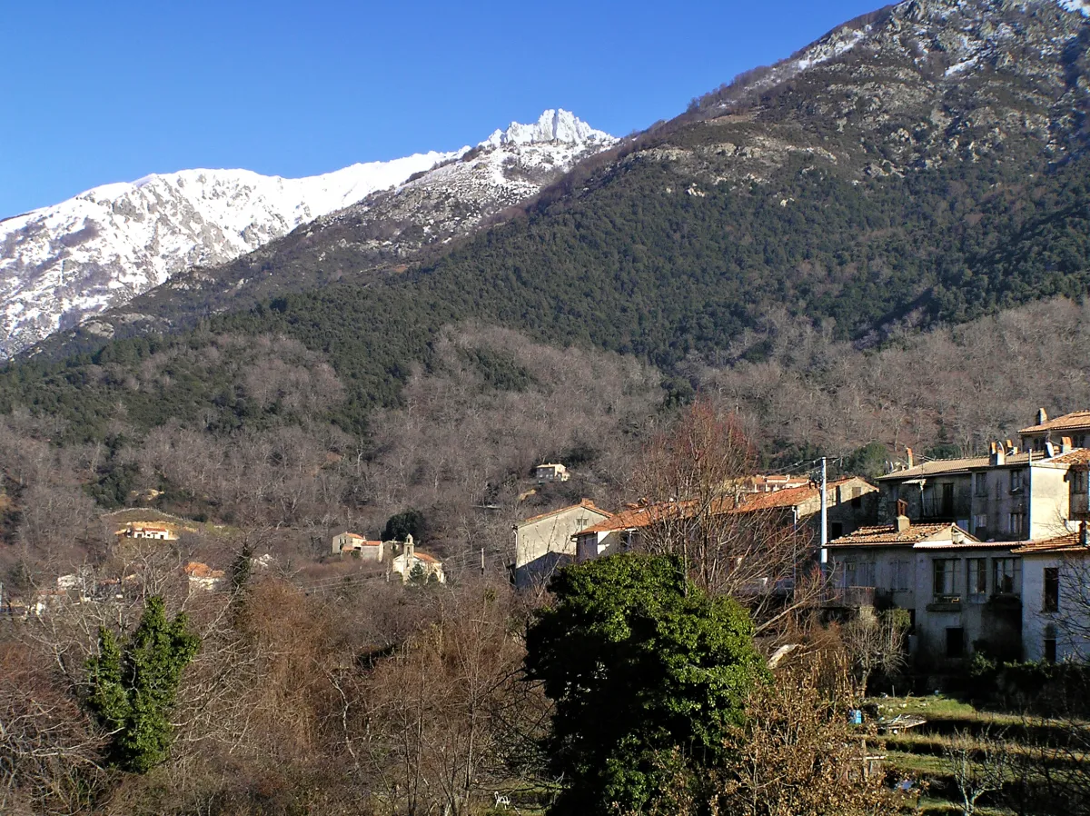

Planning your route through the Gravona valley
Start by choosing your two railway stops for the day, then read the relevant stage and its access details. The train saves you from having to retrace your steps, but you still need to plan the link between the platform and the village. Here, houses can stand above the railway. Your walk may therefore begin with a climb before the route between villages has even started. At the end, you still need to reach the station after walking through the final village.
The Carbuccia link connects the railway to the network of paths. It follows an old mule track and reveals traces of rural activity, including walls and mill remains. Plan it separately: its length is not yet firmly established enough to add it automatically to the rest. If your schedule is tight, choose another combination of stops rather than treating this approach as a few minutes’ walk.
Between Carbuccia and Ucciani, the appeal lies in a succession of small features: houses, a chapel, stone-lined paths, streams and a road section. There is no uninterrupted grand viewpoint; the landscape reveals itself through the hillside’s former uses. Ucciani then offers a place to finish the outing or prepare the next stage, allowing enough time to reach the train.
Towards Tavera, the path returns to dry-stone walls and stream crossings. There is climbing on this stage, even though its overall difficulty is rated easy. Arrival in the village offers another opportunity for a break and a return by rail. To continue towards Bocognano, find the start of the next stage; do not assume that every start and finish described is at exactly the same point in each village.
The final stage is longer. It combines paths, road sections, passages beneath the railway and several water crossings. The connection with the train is especially apparent near the railway structures. At Bocognano, chestnut trees and granite houses bring a different scale to the end of the day: the walk reaches the village before returning to its stop.
To combine stages, add only the sections you have chosen, then include station access, connections within villages and breaks. The figures below describe separate sections; they are not a guaranteed platform-to-platform total. Keep an intermediate stop as a fallback and check the timetable before extending your walk. Part of the pleasure of this crossing is the freedom to stop, provided you do not discover too late that your intended train has already gone.
One stage or several
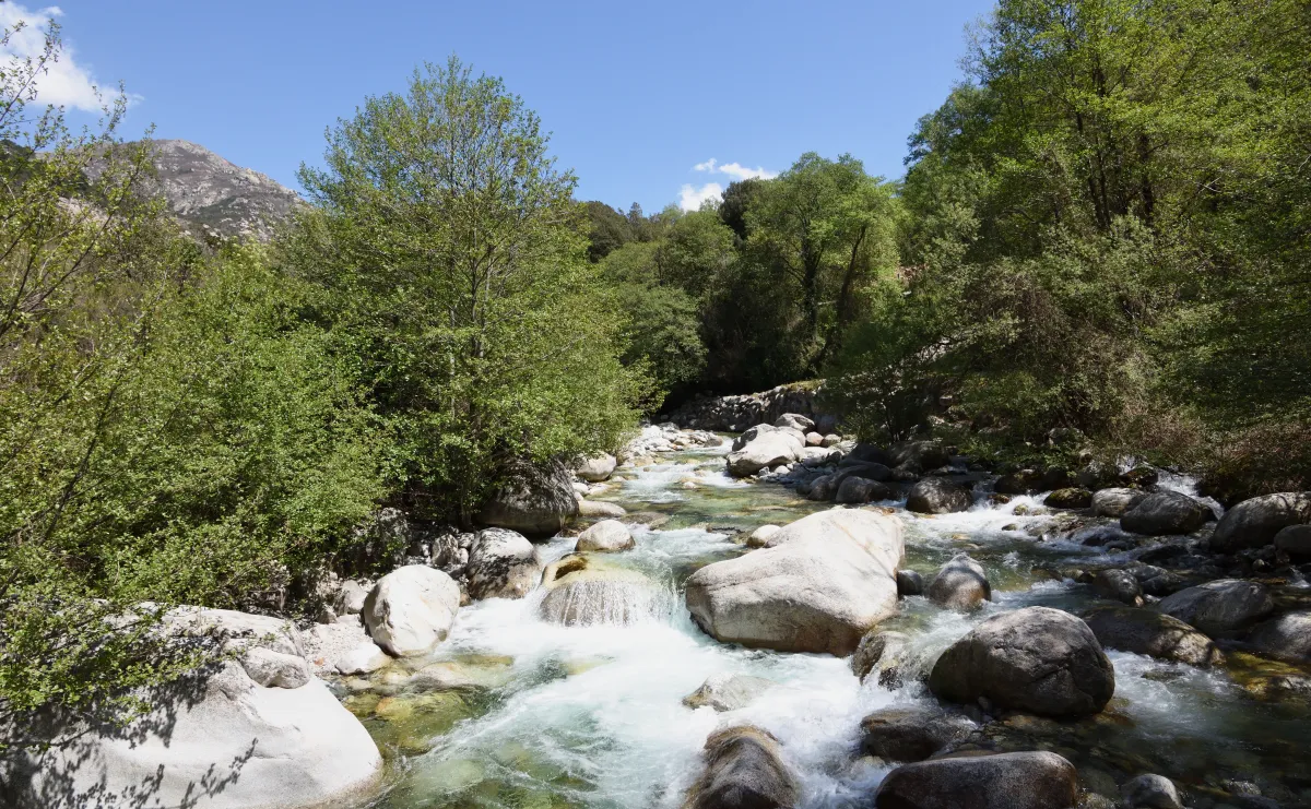
There is no single total for this walk. The three main stages can be chosen separately; the Carbuccia station–village link is an access variant. The photograph shows the Gravona at Bocognano and does not indicate a compulsory point on the routes.
Stages and alternatives
Carbuccia → Ucciani
From Carbuccia town hall to the houses of Ucciani, along rural paths and past the Sainte-Anne chapel.
- Difficulty
- Easy
- Route
- Point to point
- Distance
- 3.5 km
- D+
- 35 m
- D−
- 140 m
- Duration
- 1 h 05
The stage starts in Carbuccia near the town hall. The path leaves the houses, passing below the church area before reaching the Sainte-Anne chapel. Stone walls and fences then accompany the walk through the countryside. The terrain brings a few changes of pace, without a major climb.
At two fords, check water conditions before crossing. After the paths, a section of the D129 leads towards Ucciani and the Crucoli area. The A Filicaccia fountain is a village landmark, but you should still carry your own water. Watch for traffic on this final section. Once in the village, the day continues to the station unless you are heading on towards Tavera.
The measured route starts in Carbuccia village, not at the station. Add the station–village link described separately. At Ucciani, plan the walk to the station; the route between villages is not a platform-to-platform total.
The 3.5 km covers this stage between villages. Do not add the Carbuccia station link without checking its variant and walking time.
Ucciani → Tavera
Paths lined with walls, the Saint-Antoine chapel and a climb before descending to Tavera.
- Difficulty
- Easy
- Route
- Point to point
- Distance
- 4.6 km
- D+
- 225 m
- D−
- 155 m
- Duration
- 1 h 50
Leaving Ucciani, the walk starts near the fountain and first follows a road section before returning to a path bordered by dry-stone walls. A footbridge and then the Saint-Antoine chapel mark your progress. The route alternates water crossings with climbs up the hillside: it is not simply a level link between two villages.
After crossing a road, the climb continues towards a small pass with a table for a break. The descent then leads to the first houses and Tavera church. At junctions, follow signs for the village rather than tracks serving neighbouring land. Allow time for the final walk to the station, especially after a longer break along the way.
Add about 800 m from Ucciani station to the start and about 600 m from Tavera church to its station. These approach walks are not included in the 4.6 km shown.
After recent rain, check the condition of crossings. The easy rating describes a walk with climbing and uneven terrain; it does not guarantee suitability for everyone.
Tavera → Bocognano
The longest of the three stages, linking the heights of Tavera, railway structures and Bocognano.
- Difficulty
- Easy
- Route
- Point to point
- Distance
- 6.9 km
- D+
- 320 m
- D−
- 185 m
- Duration
- 2 h 20
From Tavera’s war memorial, head to the upper village towards Strambelacce. The path climbs between walls, joins a track and crosses a road section before descending. Follow the waymarks carefully where the route switches between road and path.
Lower down, the route meets the railway. A signposted detour leads to a view of the Granatu bridge; it is optional and adds time. The main route passes beneath the railway through a tunnel, then reaches the streams. A rope footbridge and other bridges punctuate this section. Beyond the D27, paths lead to Bocognano and its main street. Reaching the village does not mean reaching the station: leave enough time to finish on foot.
Tavera station is about 800 m from the start near the war memorial. At Bocognano, also allow about 800 m between the finish in the village and the station. These approaches are additional to the 6.9 km stage.
The detour to the Granatu bridge is stated to take about 20 minutes there and back. Do not add it if you have too little time before the train. Do not cross any footbridge marked as closed or appearing damaged.
Carbuccia station → Carbuccia village
An access walk to plan separately, reaching Carbuccia on foot from the train.
- Difficulty
- Easy
- Route
- Point to point
- Distance
- To be confirmed
- D+
- To be confirmed
- D−
- To be confirmed
- Duration
- To be confirmed
Between the station and the village, the old mule track reveals the hillside at a different pace. Walls, a threshing floor and mill remains recall the rural activities that linked the houses to the valley’s farmland. This link makes arriving by train meaningful, but it is a walk in its own right before any onward journey towards Ucciani.
The available measurements do not yet support a sufficiently reliable distance and duration for this variant. Plan the route using local information before combining it with another stage. Do not assume a very short approach simply because the station and village share a name.
Start at Carbuccia station and finish in the village. This link is separate from Carbuccia → Ucciani. Its time and distance remain to be confirmed before planning a combined day.
The figures for this link remain to be confirmed. It is excluded from the count and ranges for the three main stages shown on the map.
Along the way
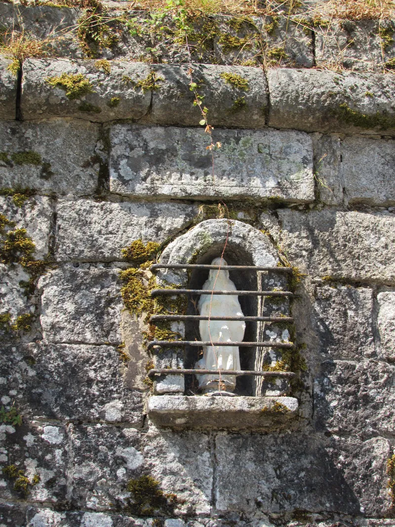
Photo credit
Photo: FredSeiller / Wikimedia Commons — CC BY-SA 4.0 · SourceChapels and fountains: Sainte-Anne near Carbuccia, Saint-Antoine near Tavera and village water points provide landmarks. The presence of a fountain does not mean its water is safe to drink.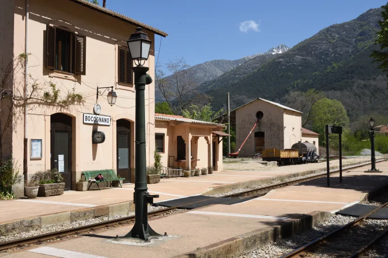
Photo credit
Photo : Mussklprozz / Wikimedia Commons · Cropped — CC BY-SA 4.0 · SourceThe railway near Tavera and Bocognano: a tunnel beneath the line and an optional detour to the Granatu bridge let you view railway structures from permitted paths.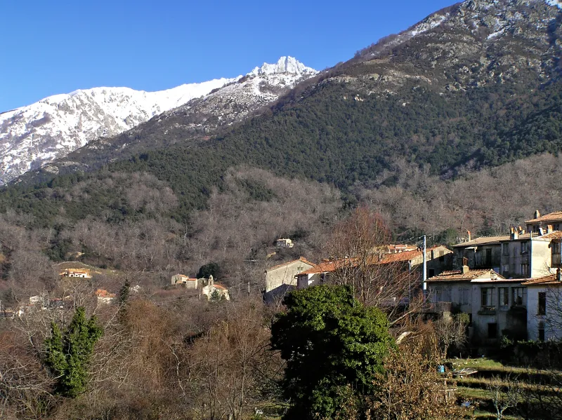
Photo credit
Photo: Pierre Bona / Wikimedia Commons — CC BY-SA 3.0 · SourceBocognano: chestnut trees and houses spread across the village invite a pause before reaching the station.
.jpg)

Practical advice
Bring walking shoes and a supply of water when you leave the train. Keep the map of station access routes available offline. Close any gates you pass and respect private plots. On road sections, remain visible and watch for traffic. Do not rely on finding an open shop for supplies.
Safety information
Do not cross a flooded ford. Check footbridges on the ground, especially on the Tavera–Bocognano stage, and turn back if a crossing is closed or damaged. An ‘easy’ rating does not remove climbs or water crossings. View railway structures from authorised access points: never use the railway tracks as a shortcut.
Photo gallery
Select a photograph to enlarge it.

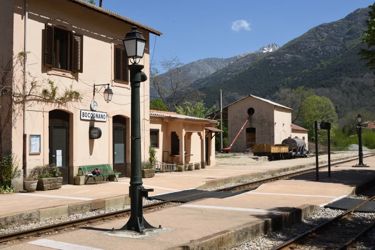
Bocognano station and the mountains of the Gravona valley.
Photo : Mussklprozz / Wikimedia Commons · Cropped — CC BY-SA 4.0 · Source